A brief history of public rights of way
Jack Cornish explores the history of our ancient routes

Jack Cornish ......
Jack Cornish is head of Paths at the Ramblers
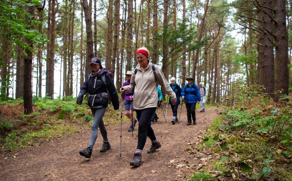
In England and Wales we are lucky to have over 140,000 miles of footpaths, bridleways and byways which make up our public rights of way network. These paths, tracks and trails are available for everyone to enjoy all year round and are used daily by the public for exercise, routine travel and to connect with nature.
Described by the poet Geoffrey Grigson as humankind’s “oldest inscriptions upon the landscape”, these paths are as much part of our shared heritage as grand cathedrals, castles and ancient hillforts. For some, one of the most pleasurable parts of walking comes from knowing you’re on an ancient path tramped by the footsteps of a dozen generations or more.
But how did this network come to be, and how was it used by our ancestors?
The history of public rights of way
People have always had to travel to survive, moving from one place to another is part of the natural rhythms of life. Movement locally, and further afield for commerce, farming, socialising, pilgrimage and, of course, recreation. Many paths and roads we use today date back hundreds or thousands of years. Before trains and cars just about all journeys were on foot as most ordinary people could not afford a horse, let alone a carriage. People got around on foot easily enough.
Until relatively modern times, no laws were passed to create public rights of way. Instead, the routes became accepted under the common law as having been public since time immemorial. The legal theory was that the landowner “dedicated” the ways as public: the public use being evidence of this.
So, over centuries, a network of tracks developed naturally from the routes that the public used to get from A to B, evolutionary desire-lines, all used on foot, with the publics’ right to use them firmly established.
On foot or by horse and cart
Walkers preferred short and direct footpaths. Sometimes these paths crossed rough or steep terrain where walking was the only option. And so different routes were developed which could be used by horse and cart. These were wider and easier to travel, but often less direct.
In the 18th and 19th centuries major changes to the pattern of paths were caused by enclosure. People took ownership of land that had previously been open fields and common land. 4,000 local Acts were passed giving Inclosure Commissioners powers to divert existing paths and roads and to create new public paths and roads.
With the advent of motor cars and buses using the cart routes, these paths eventually turned into the country lanes and main roads we recognise today. Meanwhile, footpaths became less popular as a method of everyday travel.
But their importance was recognised by the rambling movements who represented groups of people who enjoyed walking in the countryside. Lobbying by the Ramblers led to the National Parks and Access to the Countryside Act 1949, which created, together with national parks, the “definitive map”. This is the legal record of public rights of way required to be kept and updated by each local highway authority.
A history of movement in the landscape
Our paths have been used for a whole host of purposes. Long wide tracks ran from productive grazing fields in Scotland and Wales to London and other cities. These were the paths used by the drovers, taking their cattle and sheep to market on miles’ long journeys. In remote communities there were special paths to be used to carry the dead to their final burial, known as coffin roads. Paths known as the monks’ trods across Wales and south west England were used by religious and lay brothers to manage their vast productive estates and keep the faith.
Ways for food, for trade, for religion and for the dead are just some of the history that is revealed in our path network, a tangible record of people’s movement in the landscape.
The Definitive Map
The Definitive Map is an important legal record of public rights of way in England and Wales. But ...
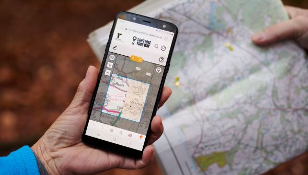
Don’t Lose Your Way – Saving lost paths
We have searched England and Wales and found over 49,000 miles of paths that could be lost ...
Claiming unrecorded public rights of way
Unrecorded paths are vulnerable to development and unresolved problems. It is important they are ...
Dealing with problems on public paths
The Ramblers guide to reporting problems on public rights of way in England and Wales. Who is ...